Finally ready for downloading in the Google Play and iTunes Stores: The Wheelmap app for Android and iOS is available with a snazzy new user interface. The map application was completely redeveloped and is now faster, clearer und user-friendlier.
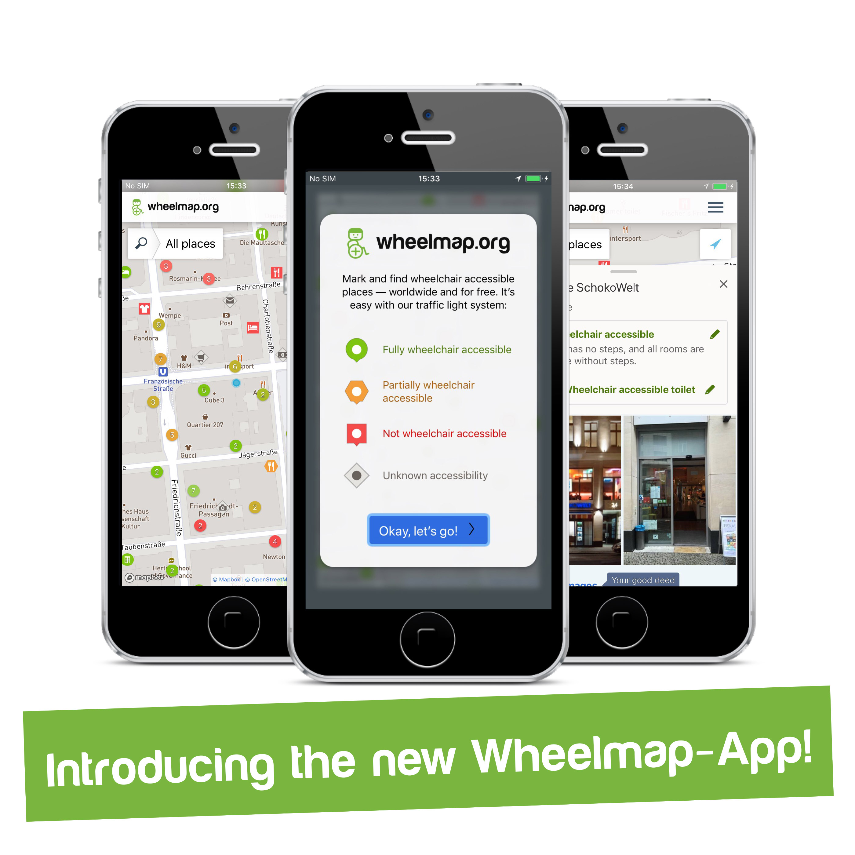
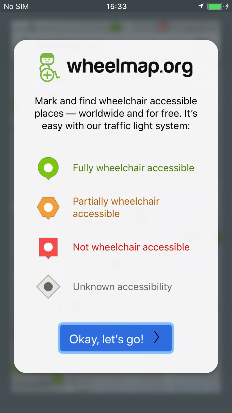
After months of development we proudly present our new app babies! We are looking forward to seeing them grow and thrive with the help of our user community. The apps‘ design has changed considerably, making it simpler and clearer.
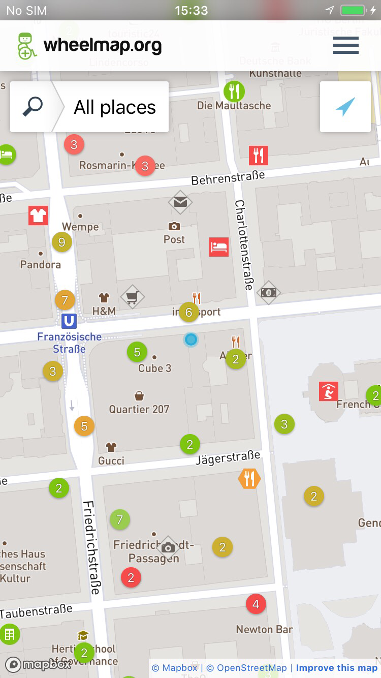
We have simplified the navigation through the app with a new base map, which labels important landmarks in the background. The search function is faster and allows for less precisely worded entries such as “cafe“ or “Greenwich Village“. New, pre-defined filters allow users to hide everything that is not important to them. Because sometimes less is more.
But since more languages are always better for our international community of users, within no time the new Wheelmap will have been translated into 25 languages, making this version easy to use from Tokyo to Rio and from Mumbai to Dubai.
Many more places from additional data sources
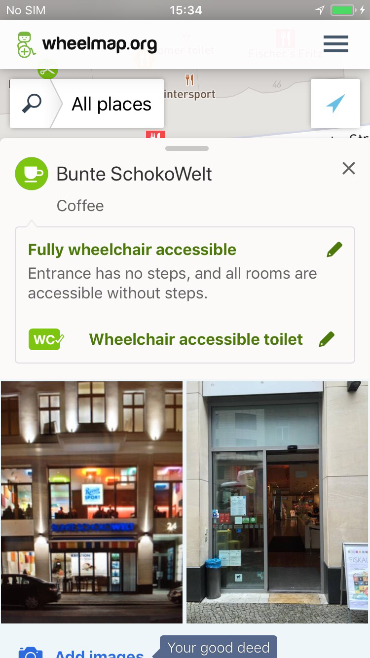
Furthermore, and perhaps not immediately obvious: we now show a lot of additional places on the map! This is because Wheelmap now incorporates other data sources with the help of accessibility.cloud and shows wheelchair accessible places from, amongst others, OpenStreetMap, FourSquare, HERE WeGo, Jaccede and AXSMap. These sources are regularly updated by members of their own user communities.
This also means that many places now contain more detailed information about their accessibility for people with disabilities. For instance we are told if a place is quiet, has automatic doors or if there is an induction loop for users with hearing aids.
Add, edit, delete – directly in OSM!
It is still possible to mark places on OpenStreetMap and to rate their entrances and restrooms without having to log in on OpenStreetMap. Also, you no longer have to log in to upload photos, entering a Captcha is enough. And the explanations provided help to ensure the quality of of the photos.
The new Wheelmap app makes a cut at the point when new places are to be added, deleted or edited and redirects the user to OpenStreetMap editor-apps, or gives the user the possibility of just leaving a note on OpenStreetMap, without logging in. This note then instructs other map-pros from the OpenStreetMap community to take care of whatever needs changing.
Now with real time information on elevators and escalators
Two new types of places have been added: elevators and escalators. In several German cities one can now see if an elevator is currently in operation or if it is out of order.
That is the real novelty of the new Wheelmap, which was developed in combination with Project Elevate. We are working on extending that feature and regularly adding more and more elevator data.
Clustering to make the map clearer
To ensure that the map is still clear, despite so many places being shown at once, the entries now appear in clusters. This results in the map showing clusters in shades between the traffic light‘s red, green and yellow when one zooms out – giving the user an idea which areas are more or less wheelchair accessible in general.
But now, enough with all the words…just try it out! We are looking forward to your feedback at [email protected]!
Download the new Wheelmap app!
Graphics: Adina Hermann/ Seabstian Felix Zappe / Screens of Wheelmap.org
Translations: Silke Georgi